Post provided by Martin Beal, Steffen Oppel, Jonathan Handley, Richard Phillips, Paulo Catry, and Maria Dias.
Identifying areas around the world that can best contribute to the conservation of wild animals is a major challenge. Historically, this required conducting extensive surveys in the field, but with the advent of miniature tracking technology we can now follow animals and allow them to indicate which areas they depend on most. In this collaborative post, international researchers from ISPA – Instituto Universitário in Lisbon, the Royal Society for the Protection of Birds, BirdLife International, and British Antarctic Survey present a new conservation tool as outlined in the paper “track2KBA: An R package for identifying important sites for biodiversity from tracking data” recently published in Methods in Ecology and Evolution.
From fruit flies to blue whales
The use of animal tracking data to unravel the mysteries of the lives of animals is experiencing a golden age. Hundreds of studies are published each year on the movements of species ranging in size from small fruit flies (Drosophila melanogaster) to blue whales (Balaenoptera musculus) recorded using electronic devices. The potential of these data to inform nature conservation is immense and well-recognized, however, the analysis of such data is not a trivial task.
Various international agreements influence the conservation and management of nature globally. For example, under the Convention on Biological Diversity, countries have set the important goal of protecting a portion of the earth’s surface for the benefit of nature. But selecting which areas would most benefit from recognition and protection is a difficult task. It has been shown that protected areas are often designated in locations with few competing development interests, however such sites are not necessarily those that would most benefit biodiversity. Identifying areas which are key to wildlife is a central task for conservation biologists – but also not a straightforward one when considering animals that travel vast distances. So how could tracking data help with this fundamental undertaking?
Developing methods to identify important sites for seabirds
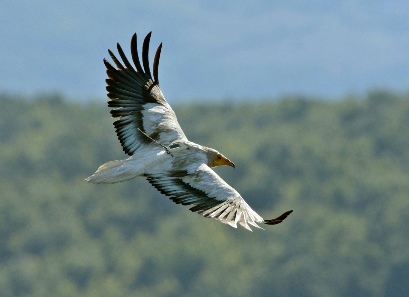
In 2009, a group of 26 researchers from around the world convened in the French village of Chizé with the aim of determining how best to use seabird tracking data to inform the identification of marine Important Bird and Biodiversity Areas (mIBAs), sites of recognized importance to birds. The group was mostly focused on the highly threatened albatrosses and large petrels, which routinely roam thousands of kilometers across oceans and are thereby difficult to study via direct observation – so methods were needed to facilitate the identification of parts of the sea that are critical to these birds. The outcome of this meeting was an outline of practical steps and considerations for translating seabird tracking data into delineated sites of importance for seabirds at sea.
The methods that resulted from the Chizé meeting and subsequent work by BirdLife International and its partner organizations have three simple steps: first, estimate where each tracked individual spends most of its time. Second, estimate how likely it is that the sample of tracked individuals actually represent the movement patterns of the wider population that they come from, thereby avoiding identifying false areas of importance. Finally, estimate how many animals actually use the identified ‘hotspots’ by combining the two first steps: how many tracked animals spend most of their time in the same place, and how does this number of animals scale up to the population level. Given a representative sample of tracked individuals and a high enough degree of animals using the same places, the final output will be a ’hotspot’ that can be assessed against standardized criteria of importance for conservation, such as in the IBA or Key Biodiversity Areas (KBA) standards.
A workflow based on these methods was later described in a paper led by Ben Lascelles of BirdLife International in 2016, which illustrated implementation for 60 seabird species and ultimately identified over 1000 sites meeting global IBA criteria. Marine IBAs are important for the global conservation of seabirds as the protection of such sites could contribute to safeguarding important foraging resources or reducing the impacts of direct threats like incidental capture in fisheries.
‘Packaging’ the methods
The methods themselves are conceptually straightforward, however, to implement the analysis was not an easy task for most conservation practitioners. Although analytical computer code was published with the 2016 Lascelles paper, running the code without published examples and detailed documentation was a challenge that limited new users. In order to make the method and its application more accessible to conservation practitioners and ecologists alike, the existing code was packaged into a digital toolbox for the programming environment R, and is called ‘track2KBA’. The main advantage of this toolbox, or package, is that the code itself now comes with use case examples and recommendations on how to prepare and analyse tracking data.
Generalizing the methods – testing for other animals
Although the methods were developed with seabirds in mind, the fact that immense amounts of tracking data are being collected on animals of all sorts begged the question of whether these methods would be applicable to other systems. Do they only work for marine species? Would they work for non-central-place foraging populations?
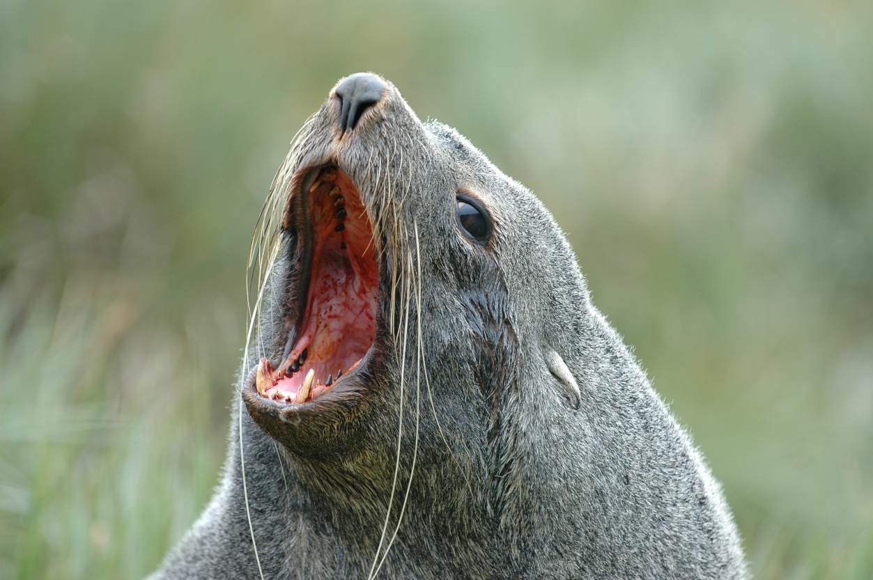
We took advantage of the labor necessary in building an R package to revisit the analysis code and test the methods in several contrasting systems. First, we used data from female Antarctic Fur Seals (Arctocephalus gazella) breeding on Bird Island, South Georgia to show that the package methods indeed work well to identify at-sea aggregations for species other than birds!
Next, we tested whether the package could identify sites for a species that don’t make repeated trips to and from a single location but disperses more widely, by analysing tracks from female Green Sea Turtles (Chelonia mydas) after egg-laying, when turtles travel to foraging grounds to recover. We found that the methods successfully flagged that the tracking samples were not representative of the wider nesting population of turtles. While that did not help to identify important sites, it provided reassurance of the conservative nature of the analysis, which is critical because it demonstrates that not every single animal track will be proposed as a potential protected area.
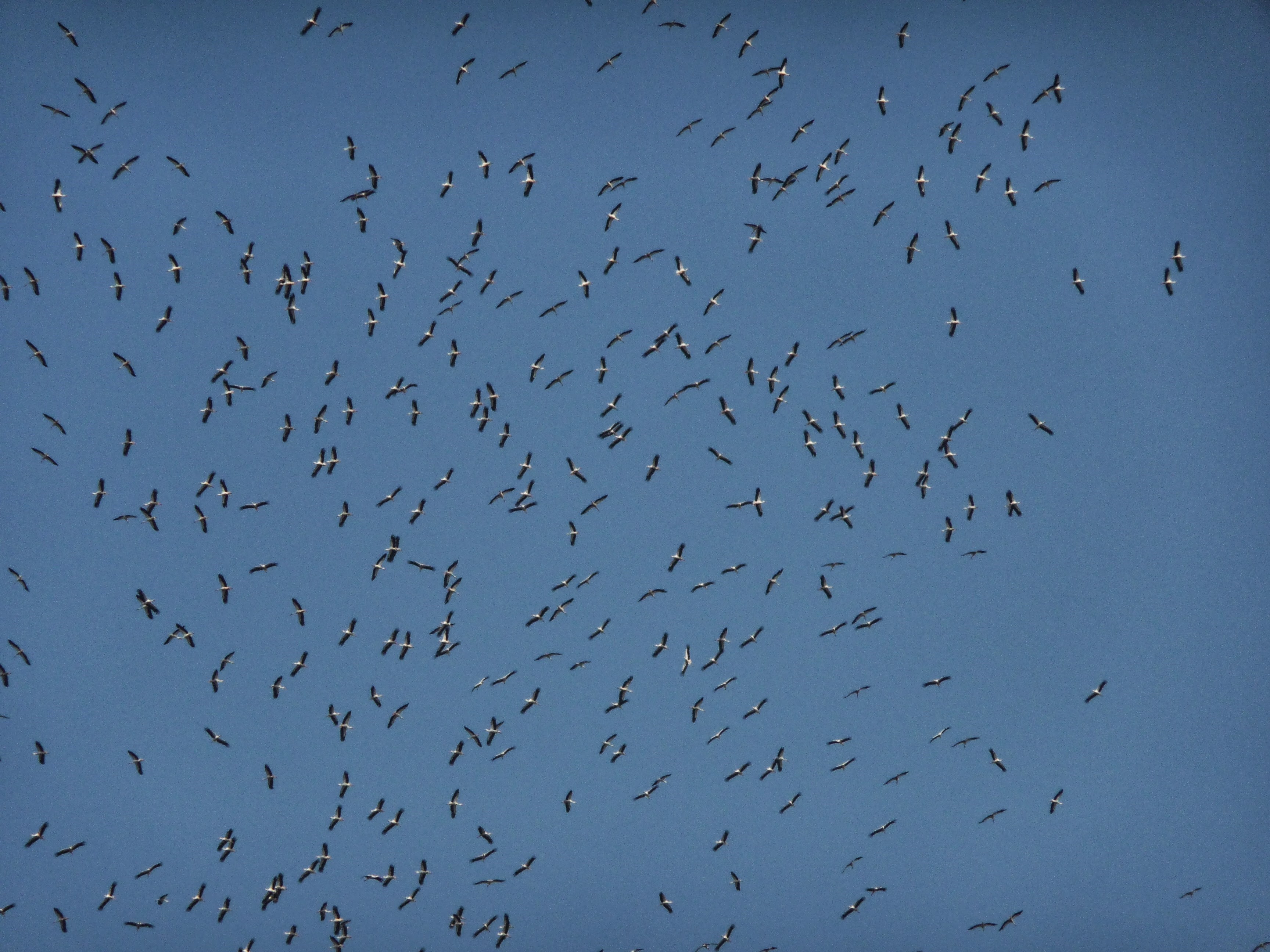
Finally, we tested the methods using data from White Storks (Ciconia ciconia) during their migration from breeding grounds in Portugal to their various wintering areas in Africa. Here, we found that the package is well suited to identify sites where migrants aggregate and spend the most time, which in the case of migratory animals likely represents locations where they stop to rest and re-fuel along the journey.
Might these methods work for my data?
You may have tracking data yourself, or are perhaps thinking about collecting some in the future. If so, then hopefully track2KBA can help you to identify important areas for your study population. There are a few relevant considerations regarding the applicability of the package and its underlying methods. First, do the animals you study aggregate in space? If they actively avoid one another (e.g., while they are territorial) then you may not be able to identify a site using these methods (perhaps for good reason!). How many tracks do you have? To estimate important sites at the population level it is important to have a representative sample. We suggest 10 tracks as a safe starting minimum. Were your tracking samples collected from the same population, during the same seasonal period? This is a crucial consideration, as animals living far apart, or tracked at various times of year may behave differently and ultimately have different sites of importance.
Although your data or system may not be appropriate (or intended) for identifying important sites for conservation using track2KBA, there are still functions in the package that you may find useful for your analysis workflow. For example, a common step in the analysis of tracking data for central-place foraging species is to split the data into discrete ‘foraging trips’ and calculate their various characteristics in space and time. In this case, the ‘tripSplit’ and ‘tripSummary’ functions may be of use to you.
A living tool
This first version of ‘track2KBA’ represents an advancement of an analysis workflow that has been in development for over a decade. An important aspect of the life of any R package (or method, for that matter) is that it can grow and evolve, and with this step we expect that further changes and growth will be necessary to accommodate new use cases. We welcome feedback on the package to assist us in maintaining track2KBA as a useful tool for a wide audience.
To download the analysis tool, visit the CRAN page or the Github landing page for more information.
Acknowledgements:
This project has received funding from the European Union’s Horizon 2020 research and innovation programme under the Marie Skłodowska-Curie grant agreement No 766417. This communication reflects only the authors’ views, and the Research Executive Agency of the European Union is not responsible for any use that may be made of the information it contains.
