
Throughout March, we are featuring articles shortlisted for the 2025 Robert May Prize. The Robert May Prize is awarded by the British Ecological Society each year for the best paper in Methods in Ecology and Evolution written by an early career author. Kal Backman’s article ‘Human inspired deep learning to locate and classify terrestrial and arboreal animals in thermal drone surveys‘ is one of those shortlisted for the award.
About the paper
What is your shortlisted paper about, and what are you seeking to answer with your research?
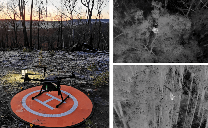
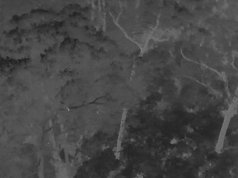
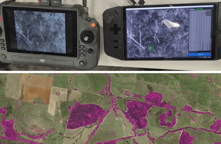
Our work focused on extracting animal sightings from large volumes of thermal video drone data (14 million images worth!) for use in abundance modelling and detection of protected species.
Unlike prior animal detection models, we took inspiration from how human pilots solved the task and integrated these techniques into our model.
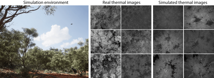
We also set out to address the main barrier of entry that prevents ecologists from training their own deep-learning models, the need for large volumes of manually labelled training data. We solved this by building a realistic thermal image simulation engine to autonomously generate and annotate training data.
Were you surprised by anything when working on it? Did you have any challenges to overcome?
One of the biggest challenges was developing a thermal image rendering pipeline that was sufficiently realistic so that knowledge learnt from simulation could be transferred to real thermal drone imagery.
But overcoming such challenge paid off as we were amazed to see the output of the first model which incorporated simulated data. Initial model predictions suffered from jittery and temporally inconsistent bounding boxes due to errors and varying quality from human annotators. The inclusion of simulated data resulted in the model outputting consistent bounding boxes that made future data annotating significantly easier.
What is the next step in this field going to be?
The next step in this field is to integrate such animal detection models in flight for automated detection and inspection of animals, allowing pilots to oversee multiple drones for greater survey area coverage.
Regarding the next step in simulated data generation, further closing the sim-to-real gap to minimise the reliance on real data is key for elusive species monitoring and reducing the human resource cost of data annotation so that ecologists can better allocate their time driving policy change and deriving ecological insights.
What are the broader impacts or implications of your research for policy or practice?
Our model enables the detection of animal sightings on vast amounts of thermal drone footage, which is key in developing abundance models that drive conservation decision making. But more importantly the sighting alerts of protected species help establish protected zones, preventing the deforestation of these critical biodiverse regions.
About the author
How did you get involved in ecology?
My PhD focused on human-robot interaction, how humans and artificial intelligence can both work together to accomplish challenging drone related missions. This led me to the opportunity with the New South Wales Department of Climate Change, Energy, the Environment and Water where I used my skills from my PhD in ecological contexts to develop systems to assist pilots in completing drone surveys and derive insights from collected data.

What is your current position?
I continue to work with the New South Wales Department of Climate Change, Energy, the Environment and Water on exciting new projects aimed at providing insights and tools to inform policy makers about the changing environmental conditions throughout the state of New South Wales, Australia.
I also work as a research engineer at Monash University, allowing me to explore research topics such as sustainable transportation, human-robot interaction, neuro-symbolic reasoning and environment simulation.
Have you continued the research your paper is about?
We have further developed the model and have deployed it on edge-devices to provide real-time in-field assistance to pilots and continue to support this program.
However our focus has shifted to addressing the main drivers of biodiversity loss through mapping of land-use change and vegetation extent using remote sensing imagery.
What one piece of advice would you give to someone in your field?
Never give up exploring the concepts and topics you love. Good research creates more questions than answers which drives future research direction and leads to surprising new opportunities that were previously unimaginable.
