Active sources of remote sensing data, in particular Light Detection and Ranging (LiDAR) and Radio Detection and Ranging (RADAR), majorly differ from passive sources by offering data of three-dimensional (3D) character, which help representing the earth terrain, surface and the related structural attributes.
This cross-journal special feature hosts a series of innovative publications from multiple disciplines, but with a common focus on the state-of-the-art science and applications of active remote sensing for ecology, biodiversity and conservation.
Below are some of the photographs taken by researchers across the special features.
Journal of Animal Ecology

Journal of Applied Ecology

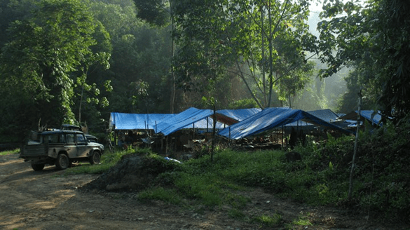
Picture 1-Photo of Dede, a research assistant, in a fragment of forest within a matrix of repeatedly logged forest at the Stability of Altered Forest Ecosystems project where the research was conducted (Photo credit Dr Dave Seaman).
Picture 2- Photo from the Stability of Altered Forest Ecosystems project where the research was conducted (Photo credit Dr Matthew Struebig).
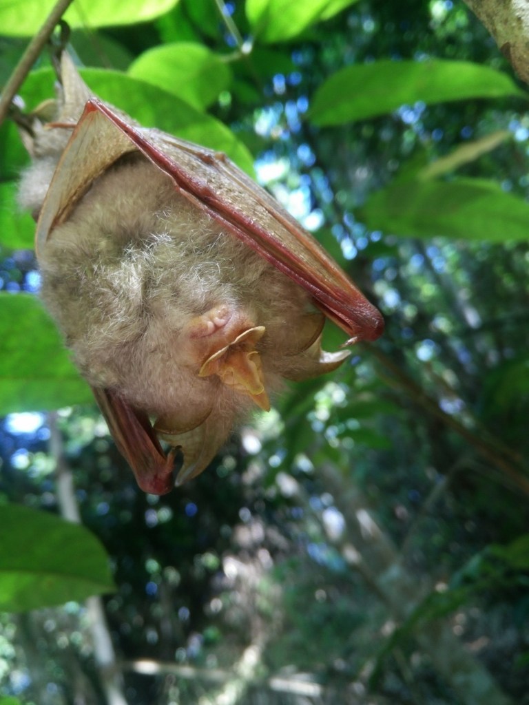
Picture 3- Photo of a Trefoil horseshoe bat (Rhinolophus trifoliatus), a locally common forest bat found across Borneo. R. trifoliatus is listed as Near Threatened by the IUCN as populations are declining due to forest loss. We found that R. trifoliatus was abundant across logged forests but did not persist in tree plantations demonstrating the potential for logging concessions to support the conservation of this species (Photo credit Dr Natalie Yoh).
Journal of Ecology
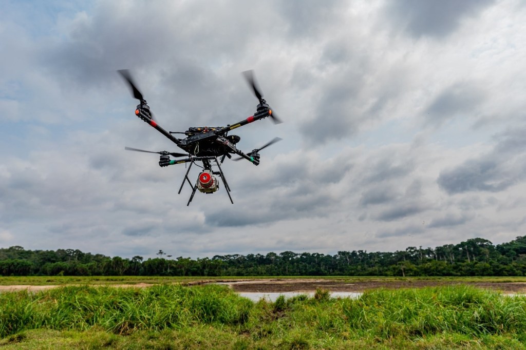

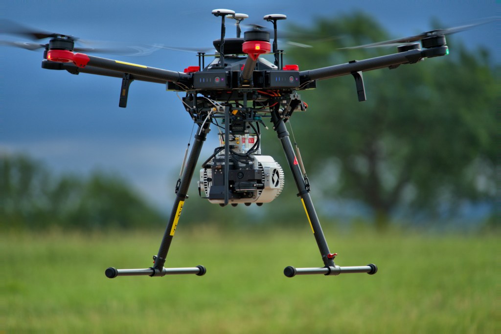
Picture 1- The Harvard Animal Landscape Observatory—a high-resolution, UAV-borne Light Detection and Ranging (LiDAR) platform—taking off in Odzala-Kokoua National Park, Republic of Congo. Active remote sensing technologies, including LiDAR and Radio Detection and Ranging (RADAR), are critical for quantifying vegetation structure in ecological, restoration, and management studies. Photo credit: Evan Hockridge
Picture 2- High-resolution Light Detection and Ranging (LiDAR) image of savanna trees in Kruger National Park, South Africa captured by the Harvard Animal Landscape Observatory (HALO). Active remote sensing methods—including LiDAR— have revolutionized the study of vegetation structural complexity, a key ecosystem trait. In their review, Coverdale and Davies show that vegetation structural complexity is positively correlated with plant diversity, suggesting that restoring biodiversity may indirectly improve ecosystem function by enhancing habitat complexity. Photo credit: Tyler Coverdale
Methods in Ecology and Evolution
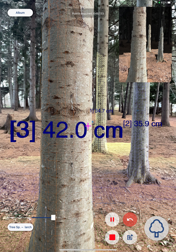
Picture 1- A screenshot of ‘ForestScanner,’ a free mobile application for measuring and mapping trees with LiDAR-equipped iPhone and iPad. As users scan trees with an iPhone or iPad, ForestScanner estimates stem diameters and spatial coordinates in real-time. The stem diameters will appear on the screen in an augmented-reality manner, as shown in the picture. We expect the application to facilitate cost-, labor-, and time-efficient forest inventories, as well as increase the accessibility to LiDAR for non-experts including students and citizen scientists. Photo credit: Shinichi Tatsumi.
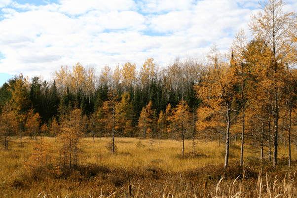
Picture 2- Protocol definitions may lead to sparse forests to be designated as nonforest due to their low canopy cover, like the tamarack bog pictured here from Sawyer County, WI, USA, the main case study in our paper. Field crews in the FIA program do not measure trees on nonforested plots even though remote sensing may predict the presence of trees, leading to a potential outlier between remotely sensed biomass and field-collected biomass. Photo credit: Sjana Schanning, USDA Forest Service, Northern Research Station, Forest Inventory and Analysis Program.
You can read all the articles from the special feature here
