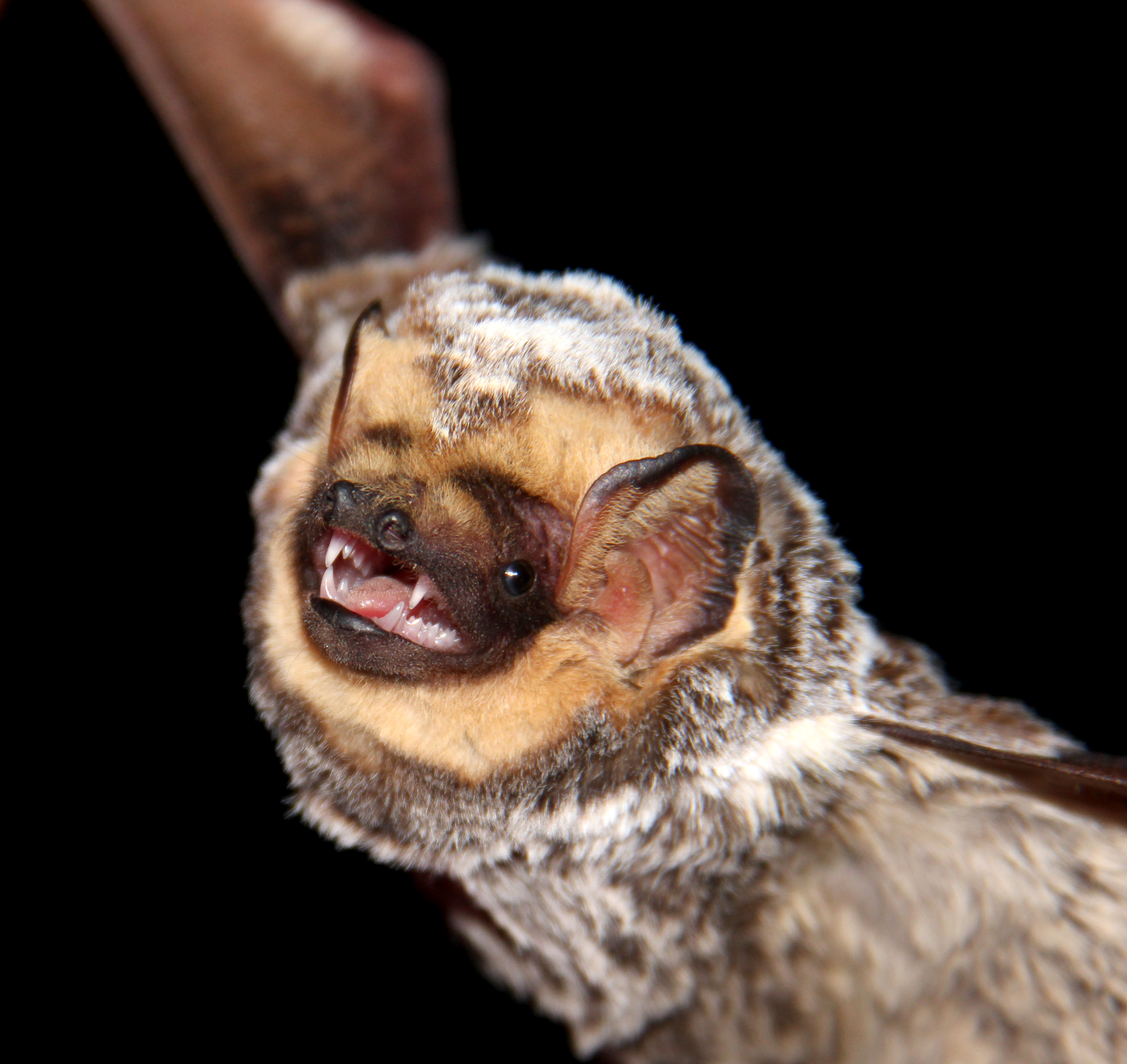
Hoary bat (Lasiurus cinereus). Credit: Veronica Zamora-Gutierrez.
Ecologists have started looking into drones as new tools for wildlife surveys, but how can drone disturbance be minimized in order to produce accurate wildlife counts? In this post, Kayla Kuhlmann describes a drone practice to reduce disruption during acoustic bat surveys as featured in the paper “Miniaturization eliminates detectable impacts of drones on bat activity”, recently published in Methods in Ecology and Evolution.
The latest issue of Methods in Ecology and Evolution is now online! This month’s issue is a little shorter than our last few. But, as they say, good things come in small packages!
Senior Editor Lee Hsiang Liow has selected six Featured Articles this month. You can find out about all of them below. We’ve also got five Applications articles and a Practical Tools article in the April issue that we’re going to cover. Those six papers are freely available to everyone – no subscription required!
At a time when data is everywhere, and data science is being talked about as the future in different fields, a method that produces huge amounts of multimedia data is camera-trapping. We need ways to manage these kinds of media data efficiently. ViXeN is an attempt to do just that.
Camera traps have been a game-changer for ecological studies, especially those involving mammals in the wild. This has resulted in an increasing amount of camera trap datasets. However, the tools to manage camera trap data tend to be very specific and customised for images. They typically come with stringent data organisation requirements. There’s a growing amount of multimedia datasets and a lack of tools that can manage several types of media data.
In ‘ViXeN: An open‐source package for managing multimedia data’ we try to fix this visible gap. Camera trap management is a very specific a use-case. We thought that the field was missing general-purpose tools, capable of handling a variety of media data and formats, that were also free and open source. ViXeN was born from this idea. It stands for View eXtract aNnotate (media data). The name is also an ode to the canids I was studying at the time which included two species of foxes.
The challenges of collecting DNA samples directly from endangered species makes understanding and protecting them harder. A new approach promises cheap, rapid analysis of genetic clues in degraded and left-behind material, such as hair and commercial food products.
The key to solving a mystery is finding the right clues. Wildlife detectives aiming to protect endangered species have long been hobbled by the near impossibility of collecting DNA samples from rare and elusive animals. Continue reading “Scant Amounts of DNA Reveal Conservation Clues”
The ANDe system can help researchers tell whether endangered species are present.
In recent years, there have been a lot of studies on the use of environmental DNA (eDNA) for species detection and monitoring. This method takes advantage of the fact that organisms shed DNA into the environment in the form of urine, feces, or cells from tissue such as skin. As this DNA stays in the environment, we can use molecular techniques to search for traces of it. By doing this, we can determine if a species lives in a particular place.
In an age of rapid technological advances, ecologists need to keep abreast of how we can improve or reinvent the way we do things. Remote sensing technology and image analysis have been developing rapidly and have the potential to revolutionise how we count and estimate animal populations.
Using remotely sensed imagery isn’t new in ecology, but recent innovations mean we can use it for more things. Land use change and vegetation mapping are among the areas of ecology where remote sensing has been used extensively for some time. Estimating animal populations with remotely sensed imagery was also demonstrated more than 40 years ago by detecting indirect signs of an animal with some success: think wombat burrows and penguin poop.
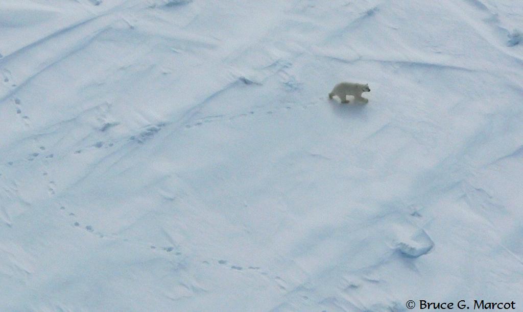
A polar bear from a helicopter
Thanks to improved spatial and spectral resolution (see the text box at the bottom of the post for a definition), accessibility, cost and coverage of remotely sensed data, and software development we have now reached a point where we can detect and count individual animals in imagery. Many of the first studies to demonstrate automated and semi-automated techniques have taken computer algorithms from other disciplines, such as engineering or biomedical sciences, and applied them to automate counting of animals in remotely sensed imagery. It turns out that detecting submarines is not so different to detecting whales! And finding abnormal cells in medical imaging is surprisingly similar to locating polar bears in the arctic! Continue reading “Remote Sensing for Counting Animals: Polar Bears, Sheep and Everything In-Between”
Lead author Jarrod Hodgson, University of Adelaide, standing in one of the replica colonies of seabirds constructed for the #EpicDuckChallenge.
A few thousand rubber ducks, a group of experienced wildlife spotters and a drone have proven the usefulness and accuracy of drones for wildlife monitoring.
A study from the University of Adelaide showed that monitoring wildlife using drones is more accurate than traditional counting approaches. This was published recently in the British Ecological Society journal Methods in Ecology and Evolution.
Monitoring is a fundamental step in the management of any species. The collection and careful analysis of species data allows us to make informed decisions about management priorities and to critically evaluate our actions. There are many aspects of a natural system that we can measure and, when it comes to monitoring the status of species, occurrence is a commonly used metric.
Ecologists have a long history of collecting species occurrence data from systematic surveys and our ability to gather species data is only going to grow! This is partly enabled by the fact that citizen science programs are starting to gain a prominent role in wildlife monitoring. There’s a growing recognition that well-managed citizen science surveys can produce useful data, while scaling up monitoring effort thanks to the increased human-power from large numbers of committed volunteers. Continue reading “Uncertainties in Species Occurrence Data: How to deal with False Positives and False Negatives”
Post provided by ALISTAIR HOBDAY (senior principal research scientist, CSIRO Australia), Tim Lynch (senior research scientist, CSIRO, Australia) and Rachael Alderman (wildlife biologist, Tasmanian Department of Primary Industry, Parks, Water and Environment, Australia).
Behavioural and ecological research and monitoring of wildlife populations are based on collection of field data. Demographic data, such as breeding frequency, birth rates and juvenile survival, have been critical in understanding population trends for a wide range of species.
Photography has been extensively used by field biologists and ecologists to gather these data and they have been quick to take up improvements in this technology. Many field programmes today use photography either for primary data collection or the communication of results. Advances in digital photography, image storage and transmission, image processing software and web-based dissemination of images have been extremely rapid in recent years, offering ecologists and biologists a range of powerful tools.
Digital imagery has been captured from a wide range of platforms, each of which has various advantages and limitations for biological study. The most remote images are captured from satellite-based sensors, which have been used to assess population abundance of large animals, such as elephant seals, or locate colonies of emperor penguins. Cameras mounted on aircraft can also provide large-scale perspectives but both of these platforms suffer from high cost, operational limitations due to weather, and limited temporal replication. Recent use of drones, while cheaper, still requires a person to be close to the survey location and can only be used in short bursts, typically lasting less than 20 minutes.
Land-based cameras – or those fixed onto animals – can track behaviour closely, but have low sample size as data tends to be collected at the scale of individual or small groups. To improve replication, fleets of remote cameras can be used or multiple images stitched together post hoc to form a montage. However, this increases cost, either for hardware or labour to manually construct panoramas. To date all these camera systems have had limits to their spatial and/or temporal resolution and, therefore, to the number of individuals covered. This restricts biological study at the population level. Continue reading “High-Res Camera Surveys of Wildlife Colonies: The advantages over traditional approaches”
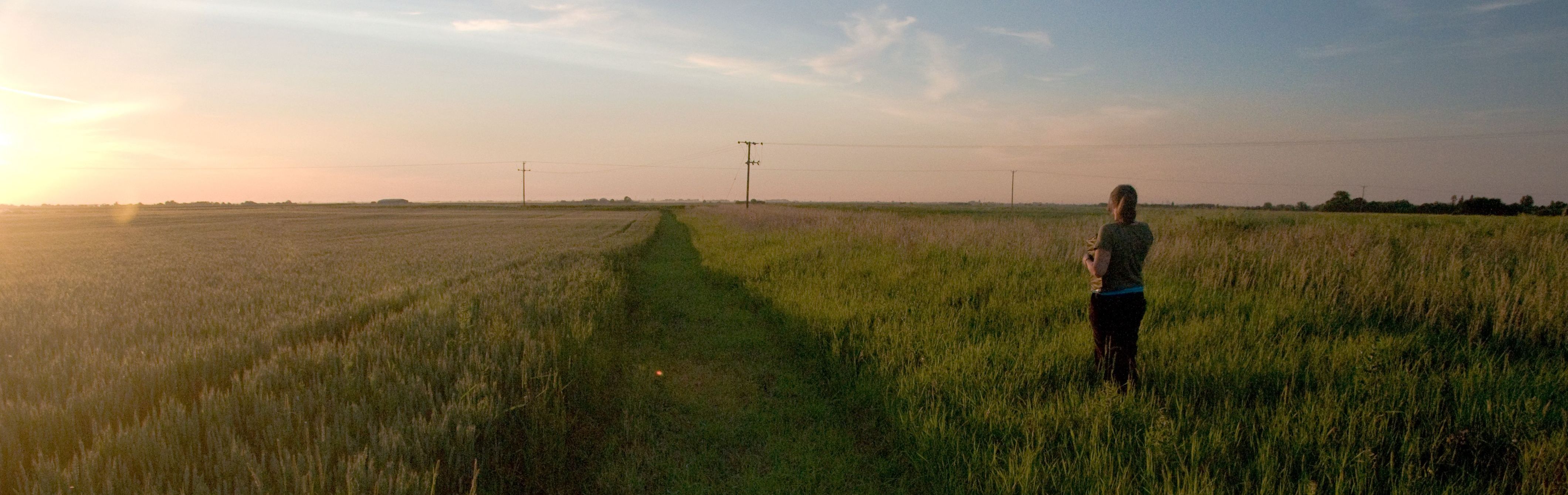
It’s 6am on a warm spring morning and I’m about to visit the second of my Breeding Bird Survey1 sites. Like 2,500 other volunteers in the UK, twice a year I get up early to record all the birds I see or hear on the two transects in my randomly selected 1km square. Each year I look forward to these mornings almost as much for the comparisons as the actual sightings. Will there be more or fewer sightings of our summer migrants this year? How will numbers in this rolling Norfolk farmland stack up against those I see in urban, central Norwich?
But simply recording these changes is not enough; we need to understand why they occur if action is to be taken. This requires us to quantify the demographic rates (survival, productivity and movements) that underlie them, which in turn requires samples of marked individuals. Simply counting individuals is not enough. Continue reading “Making the Most of Volunteer Data: Counting the birds and more…”